 Rewind
World map projections
How big is Africa, really?
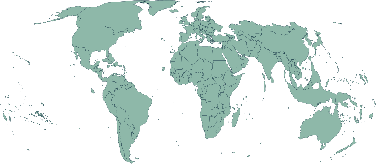
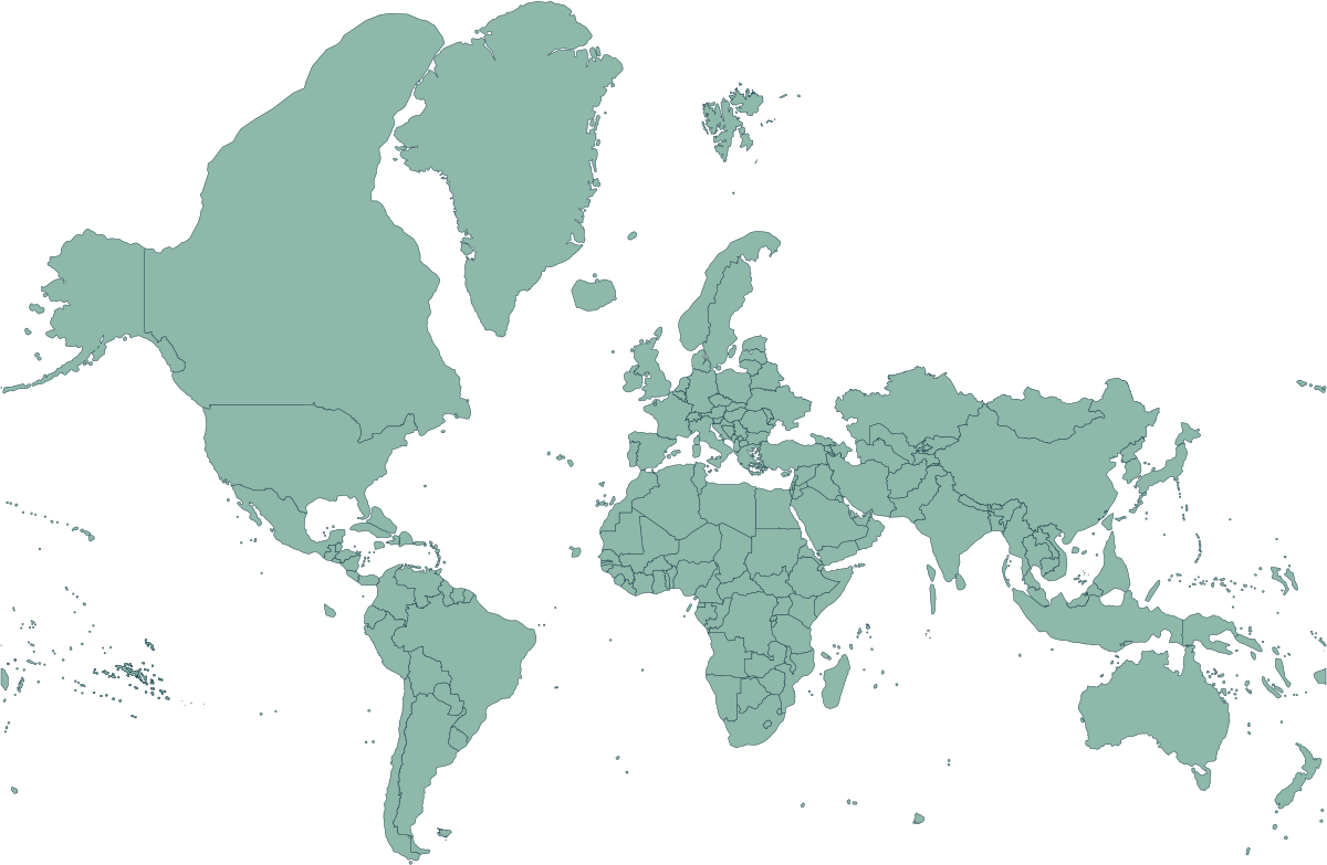
A flat map has to distort something. Equal Earth keeps land areas in proportion, so Africa, South America and Greenland can be compared fairly. Mercator preserves local angles but enlarges places toward the poles.
Equal Earth · equal area
Mercator · familiar flat map
What changed in 2026?
The African Union backed the Correct the Map campaign, and the UN General Assembly encouraged the use of equal-area world maps. This is a change in how the world can be shown, not a change to country borders. No flat projection is perfect for every purpose.
About these borders
Both images use the same 2026 OpenHistoricalMap border snapshot. Historical border coverage is incomplete, and some boundaries are disputed. The comparison shows what the projection changes; it does not certify every boundary.